The official trail-head is in the Taylor Ridge Campground, and there is no parking other than for campers. So I picked up the trail at the end of the extension which is what brought me to Ogle Lake.
 |
| Ogle lake is where the extension begins. |
When I entered the gate to the park, I ran into construction. They were having the roads repaired. After winding through the road patching, I got to the Ogle Lake parking lot, which was being entirely resurfaced. As a result, the first 1/4 mile of the had the faint smell of hot asphalt, and the constant beeping of construction equipment backing up. As soon as I topped the first ridge, however, that was gone.
As you approach the trail, There is a small opening in the trees. It gives the impression of a gateway into the trail.
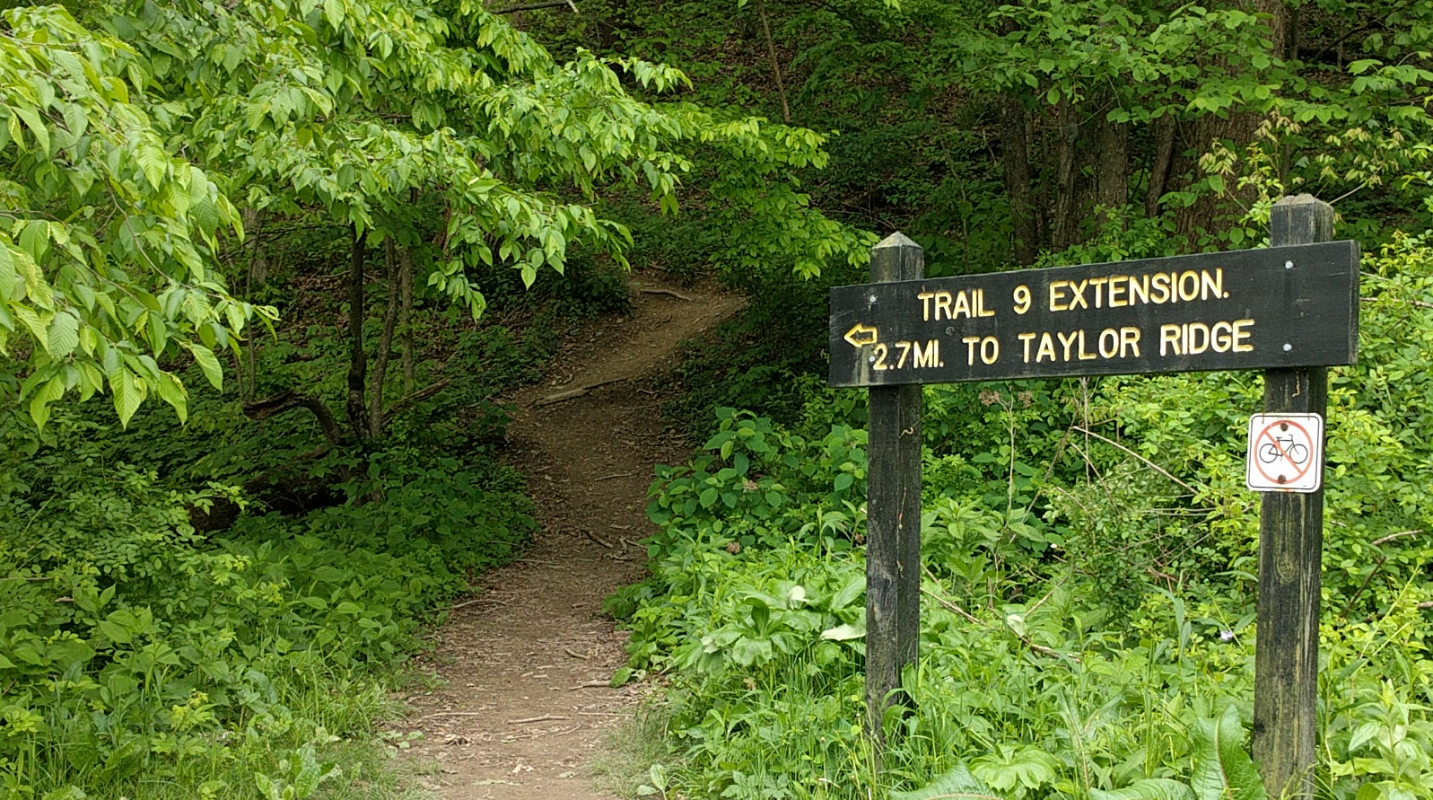 |
| The start of the Taylor Ridge Trail 9 Extension |
The trail starts with a steep 8 foot incline that turns left and rises steadily up the side of the ridge. There are few switchbacks for most of the trail; most uphills will incline in one direction up to the top of the ridge. The temperature was around 62 - 64 deg. F. I started with a flannel shirt & by the time I finished the first 1/4 mile up the ridge, a t-shirt was plenty.
The wildlife tended to be small: squirrels, striped ground squirrels, and songbirds.
 |
| One of the locals checking out the intruder. |
On the plus side, despite the recent rain, there were no mosquitoes. No bugs at all really, except for a deer fly that wouldn't leave me alone for 100 feet more or less. Vegetation consisted of a beautiful lush green forest, but sparse enough where you could see a few hundred feet down the sides of the hills. I counted what I think to be 3 different varieties of ferns.
 |
| Some of the different types of ferns that thrive along the trail |
The streams were really cool. Stream beds were all sedimentary rock. In most places, the crushed pieces gathered to form the streambed, but every now and then, you run across a portion of the stream that flowed right over the flat layer of sedimentary rock exposed by erosion.
 |
| A section of stream that has eroded all the way down to the rock. |
The trail quality was excellent. Trail was well-worn, and signs and posts were well placed to keep you on-trail. (There is no blazing on the trees).
More often, where logs had fallen across the trail, they were cut on each edge of the trail. There were 2 or 3 left from the recent storms that had not yet been cut. The $7 I paid for entry was well worth it, if only for the maintenance and care that went into keeping the trail up.
3 miles in, after crossing over two ridges, you hit the official trail 9 loop. I took it to the campground, then back to the loop to finish the trail. Total length was 8.01 miles.
Taylor Ridge Trail is Brown County Park's most difficult trail. The Property Map (a pdf on the State Park's website) has it listed as "rugged". The loop (the trail without the extension) was rated as "moderate" on the trail-head sign in the campground. While it was a workout, it wasn't too difficult, and I'd have a hard time thinking of it as rugged. Stream crossings tended to be simple, as the streams were, at most 3 or 4 inches deep, and had rocks to help keep your feet dry. In one place where the runoff eroded down about 5 feet, there was a bridge to help you across.
My overall impression, having now hiked multiple locations in both Indiana and Illinois, is that Indiana seems to do a better job maintaining trails, as well as publishing trail maps and information than does Illinois.


Details:
Min. Altitude: 162m
Max Altitude: 318m
Cumulative ascension: 517m
Distance: 13km (8.01mi)
Duration: 3hr 1min
Temp: 65 deg F
No comments:
Post a Comment